Diane Richardson 403.397.3706
Kneehill County Land Use Bylaw: A Property Buyer's Guide
When purchasing property in Kneehill County, Alberta, understanding the land use regulations that apply to your specific parcel is essential before making an offer. The current governing document is Kneehill County Land Use Bylaw No. 1808, which has been amended and updated multiple times since adoption. Key amendments include Bylaw 1889 addressing renewable energy developments. The Municipal Development Plan, which provides the overarching framework for land use policy across the county, is governed by Bylaw No. 1829.
Always verify current regulations directly with Kneehill County Planning and Development at 403-443-5541 before purchasing, as bylaws are amended regularly. For current listings in the area, browse Kneehill County acreages for sale or all Kneehill County real estate listings.
Overview: How the Land Use Bylaw Works
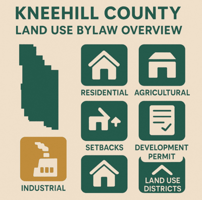
Kneehill County's Land Use Bylaw organises the county into land use districts, defines what activities are permitted on each parcel, and sets the procedures for development permits, redesignations, and subdivisions. Every parcel in the county has a designated land use district, and buyers must understand what that designation permits before purchasing.
The bylaw has been reviewed and revised to reflect Council's current Strategic Plan and community vision. Planning decisions are guided by a hierarchy of documents: the Municipal Development Plan (Bylaw 1829) sets overarching policy; the Land Use Bylaw implements that policy at the parcel level; and Area Structure Plans and Intermunicipal Development Plans provide additional guidance for specific areas and shared municipal boundaries.
For assistance in determining the land use district for a specific parcel, or for guidance on any development proposal, contact Kneehill County Planning and Development at 403-443-5541. The county office is located at 1600 2nd Street NE, Three Hills, Alberta.
Key Land Use Districts in Kneehill County
Kneehill County Land Use Bylaw 1808 includes the following main district designations:
- Agricultural (A) District: The primary district for farming, ranching, and agricultural operations across the county. Most rural land in Kneehill County falls within this designation. Permitted uses include farm residences and agricultural buildings. Non-agricultural uses typically require discretionary approval or a redesignation.
- Country Residential (CR) District: For low-density rural residential development on larger parcels, suited to buyers seeking a rural acreage without active agricultural operations.
- Hamlet Residential (HR) District: For residential development within Kneehill County's hamlets including Acme, Carbon, Linden, Torrington, and other communities. Subject to hamlet-specific regulations.
- Hamlet General (HG) District: Allows for a mix of residential and light commercial development within hamlets, providing flexibility for small business operators within hamlet boundaries.
- Local Rural Commercial District: For rural commercial uses outside hamlet areas. Confirm specific permitted and discretionary uses with Kneehill County Planning.
- Light Industrial (LI) District: For light industrial businesses and operations. Recent activity includes a redesignation from Agricultural to Light Industrial for a Bitcoin mining and data centre operation (Bylaw 1894, 2024).
- Direct Control (DC) District: Site-specific districts for unique developments that do not fit standard categories. Each DC district has its own specific regulations set by Council.
The bylaw has been updated to add new land use districts, new definitions, and changes to subdivision rules since its original adoption. Always confirm your parcel's current district designation with Kneehill County Planning.
Notable Provisions in Bylaw 1808
Several provisions in Kneehill County's Land Use Bylaw 1808 are particularly relevant for rural property buyers and acreage owners:
- Storage containers on AG land over 20 acres: Storage containers on lands zoned Agriculture District greater than 20 acres do not require a development permit. This is a practical exemption for agricultural property owners who need on-site storage. Smaller parcels or other districts may have different requirements.
- Hens in hamlets: The bylaw includes specific regulations permitting hens within Kneehill County hamlets. This is a notable provision for buyers interested in small-scale poultry keeping within hamlet boundaries. Confirm applicable conditions and limits with Kneehill County Planning.
- RV storage facilities: The bylaw includes new regulations that allow for RV storage facilities in the county, reflecting growing demand for recreational vehicle storage in rural Alberta.
- Renewable energy (Bylaw 1889): Land Use Bylaw 1808 was amended by Bylaw 1889 to address the review and permitting of renewable energy systems in Kneehill County. Buyers considering properties that may be affected by or used for renewable energy development should confirm current requirements with Kneehill County Planning.
- Business licences for non-residents and mobile businesses: A business licence may be issued for non-residents wanting to do business in Kneehill County or for mobile businesses operating within the county.
Permitted and Discretionary Uses
Within each land use district, uses are classified as either permitted or discretionary:
- Permitted Uses: Allowed as of right provided all development standards of the district are met. The Development Officer can approve a development permit for a permitted use without requiring referral to the Municipal Planning Commission.
- Discretionary Uses: Require review and approval beyond the standard permit process. Discretionary use applications are decided by the Municipal Planning Commission. Examples include home-based businesses, home occupations, and certain commercial uses in agricultural or residential districts.
What a previous owner operated on a property is not necessarily what a new owner is permitted to do. Verify permitted and discretionary uses for your specific parcel's district before purchasing.
Development Permits: What Requires One
A development permit is required for most construction, land use changes, and significant modifications to properties in Kneehill County. Development undertaken before a permit is approved is illegal under the Land Use Bylaw.
Key exemptions confirmed in the bylaw include storage containers on Agriculture District land greater than 20 acres. Other exemptions may apply within specific districts. The development permit application process involves:
- Determining the land use district for your property and confirming your proposed use is permitted or discretionary.
- Reviewing allowable uses and development standards for that district.
- Preparing required documentation including site plans and any environmental studies if required.
- Submitting a complete application to the Kneehill County Planning and Development Department.
- For permitted uses: the Development Officer has authority to approve. For discretionary uses: the application is referred to the Municipal Planning Commission with adjacent landowner notification and an appeal period.
For forms and application procedures, visit the Kneehill County Planning Tools page or contact Planning and Development at 403-443-5541.
Development Authorities: Who Decides
Understanding who makes planning decisions in Kneehill County is important for buyers and developers:
- Kneehill County Development Officers: Act as the Development Authority for permitted use applications and routine development permit decisions.
- Municipal Planning Commission (MPC): Acts as both the Development Authority for discretionary use applications and as the Subdivision Authority for all subdivision applications in the county. The MPC is the body that hears and decides on contested or complex planning matters.
- Intermunicipal Planning Commission: Where an Intermunicipal Development Plan Bylaw is in effect between Kneehill County and an adjacent municipality, an Intermunicipal Planning Commission serves as the development authority for certain fringe areas. This applies along the boundaries with Ten Hills, Trochu, Acme, Carbon, Linden, and other adjacent municipalities.
Setbacks and Parcel Size Requirements
Setbacks define the minimum distance structures must be placed from property lines, roads, and other features. Typical setbacks in Kneehill County include:
- Residential buildings: Front yard 7.6 metres (25 feet); side yard 7.6 metres (25 feet); rear yard 7.6 metres (25 feet).
- Accessory buildings: Front yard 7.6 metres (25 feet); side yard 1.5 metres (5 feet); rear yard 1.5 metres (5 feet).
- Hamlet/ex-hamlet districts: Variances of up to 15% of any minimum or maximum standard may be considered without requiring a full variance application.
Setback requirements vary by land use district. Always verify specific setbacks for your parcel's district with Kneehill County Planning and Development before purchasing or planning any construction.
Non-Conforming Uses
Non-conforming uses are properties or activities that were legally established under previous bylaw provisions but do not fully comply with the current version of Land Use Bylaw 1808 following amendments. Non-conforming uses may continue but are restricted: they cannot be substantially expanded or changed without compliance with the current bylaw. Purchasing a property with a non-conforming use does not automatically transfer the right to continue or expand that use. Confirm the status of any non-conforming use with Kneehill County Planning before purchasing.
Overlay Districts and Environmentally Significant Areas
Certain areas in Kneehill County are subject to overlay districts that impose additional regulations for environmental protection, flood hazard management, steep slopes, or other specific concerns. Properties within these areas may require additional permits, assessments, or compliance with extra regulations before development can proceed.
Kneehill County retained Summit Environmental Consultants Ltd. to produce an Environmentally Significant Areas (ESA) report, which identifies and maps areas of high environmental sensitivity across the county. Properties near identified ESAs may be subject to additional development considerations. Review the ESA mapping with Kneehill County Planning before purchasing any property near environmentally sensitive features.
Area Structure Plans
Kneehill County has five active Area Structure Plan Bylaws that provide additional planning direction for specific communities and development areas. Buyers considering properties in or near these areas should review the applicable ASP:
- Kneehill Creek (Bylaw 1263)
- Three Hills Creek (Bylaw 1289)
- Saddle-Up Estates (Bylaw 1586)
- Badlands Motorsports Resort (Bylaw 1597)
- Crocus Coulee Estates (Bylaw 1611)
Intermunicipal Development Plans
Kneehill County has Intermunicipal Development Plans in place with ten adjacent municipalities. These IDPs coordinate land use planning in fringe areas near shared boundaries and may affect planning decisions for properties near county borders:
- Acme (Bylaw 1807)
- Carbon (Bylaw 1804)
- Linden (Bylaw 1801)
- Drumheller (Bylaw 1817)
- Red Deer County (Bylaw 1802)
- Rocky View County (Bylaw 1805)
- Starland County (Bylaw 1869)
- Three Hills (Bylaw 1810)
- Trochu (Bylaw 1797)
- Wheatland County (Bylaw 1806)
If you are considering a property near any of these municipal boundaries, confirm whether the applicable IDP affects your planned use with Kneehill County Planning.
Renewable Energy in Kneehill County
Kneehill County has been actively dealing with renewable energy development proposals, including solar and wind energy projects. Key points for buyers:
- Bylaw 1889 amended Land Use Bylaw 1808 to address the review and permitting of renewable energy systems in the county.
- The Land Use Bylaw requires that an open house or information session be held by a renewable energy proponent prior to Council consideration of any application.
- Buyers considering properties in areas where renewable energy projects are proposed or active should research current project status before purchasing, as proximity to wind or solar installations may affect property use and enjoyment.
- Renewable energy developments are also subject to provincial regulatory oversight through the Alberta Utilities Commission (AUC).
Due Diligence Checklist Before You Make an Offer
Buyers should complete the following checks before making any offer on a Kneehill County property:
- Confirm the land use district designation for the specific parcel
- Review permitted and discretionary uses for that district
- Verify setback requirements and whether all existing structures comply
- Request a Real Property Report and confirm bylaw compliance with the county
- Confirm development permit requirements for any planned construction or changes
- Check for overlay districts, ESA designations, or flood zone areas
- Confirm whether any applicable Area Structure Plan or Intermunicipal Development Plan affects the parcel
- Check proximity to any proposed or active renewable energy projects
- Verify well water and septic system condition through independent inspection
- Confirm road access and maintenance responsibility
See also the rural real estate FAQ, the septic and well inspection checklist, the well water guide for Alberta acreage buyers, and the how to buy an acreage guide.
Kneehill County Property Search
Browse current listings across Kneehill County:
- Kneehill County Acreages for Sale
- Luxury Acreages in Kneehill County
- Equestrian Properties in Kneehill County
- Kneehill County Homes for Sale
- Land for Sale in Kneehill County
- Three Hills Real Estate
- Trochu, Acme, and Carbon Real Estate
- Farms for Sale Across Alberta
- Horse Ranches Across Alberta
- Central Alberta Acreages for Sale
- Kneehill County School Districts Guide
- Kneehill County Parks and Recreation Guide
- All Kneehill County MLS Listings
- Interactive Map Search
- Kneehill County Planning Tools (Official)
Frequently Asked Questions: Kneehill County Land Use Bylaw
What is the current Land Use Bylaw for Kneehill County?
The current bylaw is No. 1808, amended by Bylaw 1889 for renewable energy and other subsequent amendments. The Municipal Development Plan is Bylaw No. 1829. Always verify the current version with Kneehill County Planning at 403-443-5541 before making any development decisions.
What are the main land use districts in Kneehill County?
Agricultural (A), Country Residential (CR), Hamlet Residential (HR), Hamlet General (HG), Local Rural Commercial, Light Industrial (LI), and Direct Control (DC). Confirm your parcel's specific designation with Kneehill County Planning before purchasing.
Do storage containers need a development permit in Kneehill County?
Storage containers on Agriculture District land greater than 20 acres do not require a development permit. On smaller parcels or in other districts, a permit may be required. Confirm with Kneehill County Planning at 403-443-5541.
Are hens permitted in Kneehill County hamlets?
Yes. Land Use Bylaw 1808 includes regulations permitting hens within Kneehill County hamlets, subject to applicable conditions. Confirm the specific rules with Kneehill County Planning.
Who approves development permits in Kneehill County?
Development Officers approve permitted use applications. The Municipal Planning Commission (MPC) decides on discretionary use applications and all subdivision applications. The MPC also serves as the Subdivision Authority for the county.
Are renewable energy developments regulated in Kneehill County?
Yes. Bylaw 1889 amended the Land Use Bylaw to address renewable energy review and permitting. An open house or information session by the proponent is required before County consideration. Confirm current requirements with Kneehill County Planning at 403-443-5541.
Where can I find a Kneehill County real estate agent?
Contact Diane Richardson at 403-397-3706 for guidance on buying property in Kneehill County. She has over 15 years of experience with rural acreage and farm purchases across Alberta.

About Diane Richardson
Diane Richardson is a licensed real estate agent with CIR Realty and has been helping buyers and sellers across Kneehill County and rural Alberta for over 15 years. She brings practical knowledge of land use bylaws, rural due diligence, and the buying process to every transaction. Contact Diane at 403-397-3706 or diane@mypadcalgary.com. Read client reviews on the testimonials page.
Last updated: March 2026. Land use regulations change. Always verify current requirements directly with Kneehill County at 403-443-5541 before making any purchase or development decisions. Source: Kneehill County Land Use Bylaw No. 1808.

CIR REALTY
Office
703 64 Ave SE #130
Calgary, AB, T2H 2C3