Overview of Mountain View County Land Use Bylaw
The Mountain View County Land Use Bylaw is essential for property owners, developers, and businesses looking to understand zoning regulations, land use classifications, setbacks, and development requirements. The bylaw governs the development and use of land within the county, ensuring appropriate land utilization while preserving community values.
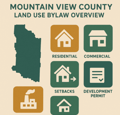
Key Areas Covered by the Bylaw
- Zoning Regulations: Divides the county into various zoning districts such as residential, commercial, agricultural, and mixed-use zones.
- Setbacks: Requirements on how far structures must be from property lines, roads, and other infrastructure to ensure safety and privacy.
- Land Use Districts: Defines land usage in specific districts, including Residential, Agricultural, Commercial, and Industrial zones, each with distinct rules.
- Permitted and Discretionary Uses: Identifies what is permitted within each zoning district, as well as uses that may require a special review process.
- Development Permits: Outlines the process for obtaining a development permit, required for most types of new construction or changes in land use.
Specific Requirements for Development
- Residential Areas: Minimum lot sizes for residential properties depend on the district, with different setbacks for front, rear, and side yards.
- Agricultural Uses: Agricultural lands must maintain specific standards for farm operations, including setbacks from neighboring properties and infrastructure.
- Building Heights: The maximum height for buildings varies based on the district and property type, ensuring that structures do not interfere with sightlines or community aesthetics.
- Lot Coverage: Limits on how much of a parcel can be covered by buildings or impervious surfaces, which is crucial for maintaining open space and preventing overdevelopment.
Development Permit Process
In Mountain View County, almost all new developments require a Development Permit. This includes any alterations or additions to existing structures, as well as changes in land use. The process ensures that proposed projects comply with the county’s land use policies, including environmental considerations, traffic management, and community impact.
Permitted and Discretionary Uses
Within each district, there are two categories for land use: Permitted and Discretionary. Permitted uses automatically meet zoning requirements, whereas Discretionary uses require additional review and approval. For example, a single-family home might be permitted in a residential area, but a home-based business may require a discretionary permit.
Non-Conforming Uses
If a property does not meet the current land use regulations but was legally established under previous bylaws, it is considered a non-conforming use. These properties can continue to operate, but any significant changes may require compliance with the updated bylaw.
Overlay Districts
Certain areas of Mountain View County are subject to overlay districts, which impose additional rules for environmental protection, flood control, or aesthetic requirements. Development in these areas must adhere to these specific guidelines in addition to the standard zoning rules.
