Diane Richardson 403.397.3706
Newell County Land Use Bylaw: A Buyer's Guide to Property Regulations
Buying property in the County of Newell requires a clear understanding of the land use regulations that govern your specific parcel before you make an offer. The County of Newell Land Use Bylaw organises the county into land use districts, defines what is permitted on every parcel, and sets the rules for development permits, setbacks, and subdivision. This guide covers the key regulations property buyers need to understand, including the unique role of the Eastern Irrigation District in this part of Alberta.
Always verify current regulations directly with County of Newell Planning and Development before purchasing, as bylaws are amended regularly. For current listings in the area, browse acreages for sale in the County of Newell and Newell County homes for sale.
Overview: How the Land Use Bylaw Works
The County of Newell Land Use Bylaw regulates land use and development across the county. It organises land into distinct land use districts, each with its own set of permitted and discretionary uses, setback requirements, and development standards. Every parcel of land in the County has a designated land use district, and what can be built or operated on that parcel depends entirely on its district designation.
The LUB is administered by the County of Newell Planning and Development Department and directs day-to-day development decisions. Longer-range planning is guided by the Municipal Development Plan (MDP) and Area Structure Plans (ASPs). The bylaw is periodically amended by County Council following a formal public hearing process, so buyers should always verify current regulations with the County directly.
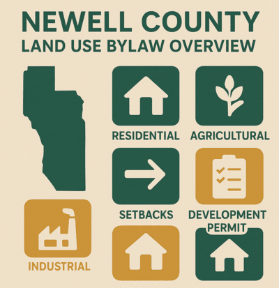
Key Land Use Districts in the County of Newell
- Agricultural District (A-GEN): The primary district for farming, ranching, and agricultural operations across the county. The majority of rural land in Newell County falls within this district. Permitted uses include farm residences, agricultural buildings, and related operations. Certain uses such as home-based businesses or agri-tourism may require discretionary approval.
- Residential Rural District (R-RUR): Intended for low-density rural residential development on larger parcels. Suited to buyers looking for a rural home without active agricultural operations.
- Business Districts (B-HAM and B-RUR): B-HAM covers hamlet-based commercial uses in communities such as Bassano, Duchess, Rosemary, and Tilley. B-RUR covers rural commercial uses outside hamlet areas. Confirm the specific district designation before purchasing any commercial property.
- Industrial District (I-GEN): For industrial activities including manufacturing, storage, and warehousing. Generally not suitable for residential use.
- Special Districts (S-PPS and S-NOS): S-PPS covers parks, schools, and public service areas. S-NOS covers natural open space. Development options in these districts are highly restricted.
Contact the County of Newell Planning and Development Department to confirm the land use district designation for any specific parcel before making an offer.
Permitted Uses and Discretionary Uses
- Permitted Uses: Uses that are allowed as of right within a district, provided all development standards are met. A development permit is still typically required before construction begins, but approval is not subject to discretion if standards are satisfied.
- Discretionary Uses: Uses that require review and approval from the County of Newell Development Authority. Approval is not guaranteed and conditions may be attached. Examples include home-based businesses, bed and breakfasts, and certain commercial or industrial activities in residential or agricultural zones.
What a previous owner operated on a property is not necessarily what a new owner is permitted to do. Verify permitted and discretionary uses for your specific parcel's district before purchasing, particularly if you plan to operate a business, keep livestock, or build additional structures.
Development Permits: What Requires One
A Development Permit is a written approval issued by the County of Newell under the Land Use Bylaw authorising development to proceed. Most construction and changes in land use require a development permit, including:
- New dwellings and moved-in dwellings
- Garages, additions, decks, and replacements
- Changes in the use or intensity of a parcel of land or building
- Excavation and stockpiling
- All development adjacent to a numbered provincial highway
Verified exemptions:
- Farm buildings constructed solely for agricultural purposes do not require a development permit, provided they meet the setback requirements and construction standards of the relevant land use district.
- Fences do not require a development permit as long as they meet the setback requirements of the district.
A development undertaken before a development permit takes effect is illegal under the Land Use Bylaw. Always confirm permit requirements with County of Newell Planning and Development before starting any work.
Development Permit Application Steps
- Confirm the land use district designation for your property and verify your proposed use is permitted or discretionary.
- Book a pre-application consultation with County of Newell Planning and Development if you are uncertain about requirements.
- Submit a completed development permit application with required documents including site plans, designs, and any supporting information.
- The County evaluates the application and circulates it to relevant agencies including school divisions, the Eastern Irrigation District where applicable, and neighbouring municipalities.
- Once approved, the decision is posted on the County's Public Participation Page during a 21-day appeal period. The approval is not final until this period has expired without a successful appeal.
For forms and detailed instructions, visit the County of Newell development permits page.
Setbacks and Parcel Size Requirements
Setbacks define the minimum distance that structures must be placed from property lines, roads, and other features. Typical setbacks for residential properties in Newell County include:
- Residential buildings: 7.6 metres (25 feet) from the front and rear property lines; 3 metres (10 feet) from the side yard.
- Accessory buildings: Minimum 1.5 metres (5 feet) from the side yard and 1.5 metres (5 feet) from the rear yard, depending on the land use district.
- Highway setbacks: Properties adjacent to a numbered provincial highway are subject to additional setback requirements. All development in these locations requires a development permit regardless of other exemptions.
Setback requirements vary by district. Verify the specific setbacks for your parcel's land use district before purchasing or planning any construction.
Real Property Report and Certificate of Compliance
Real Property Report (RPR): A legal document prepared by an Alberta Land Surveyor that illustrates the location of all development on a property relative to the property boundaries, including the dwelling, accessory buildings, decks, sheds, fences, and other structures. Sellers in Alberta are typically required to provide an RPR as part of a real estate transaction. Review it carefully with your agent and lawyer before removing conditions on any offer.
Certificate of Compliance: An endorsement by the County of Newell confirming that the development shown on an RPR meets the requirements of the Land Use Bylaw. If structures comply, the County issues a letter of compliance. If structures do not comply, the property owner must take corrective action before a Certificate can be issued. Corrective action may include removing or relocating structures, obtaining retroactive permits, or removing structures from County land such as drainage easements or utility rights-of-way. Buyers should request that a Certificate of Compliance be provided as a condition of purchase.
The Eastern Irrigation District: A Unique Newell County Consideration
The County of Newell has a land and water context that is unique in Alberta. The Eastern Irrigation District (EID) owns approximately 600,000 acres of land within the county and manages water storage, conveyance, and delivery for irrigated agricultural operations across the region, making the EID one of the most significant landowners and stakeholders in Newell County.
For buyers considering irrigated farmland or any property with EID water rights, this has direct practical implications:
- Irrigation water rights are tied to specific parcels of land and are regulated by the EID under the Irrigation Districts Act, separately from municipal land use rules.
- The transfer, increase, decrease, or subdivision of irrigation acres requires EID approval and follows specific criteria and guidelines.
- Subdivision applications in Newell County are circulated to the EID as a referral agency, and EID comments are presented to the Municipal Planning Commission.
- EID lands within the county are subject to specific access and use policies managed by the EID directly.
If you are purchasing irrigated agricultural land in the County of Newell, have the water rights reviewed by your lawyer and consult the EID directly before completing your purchase. Contact the EID at 403-362-1400 or visit eid.ca.
Non-Conforming Uses
A non-conforming use is a property or activity that was legally established under a previous version of the Land Use Bylaw but does not comply with current regulations. Non-conforming uses may continue but are restricted: they cannot be expanded, and if the non-conforming use ceases for a defined period, it cannot be restarted. Purchasing a property with a non-conforming use does not automatically transfer the right to continue or expand that use. Confirm the current status of any non-conforming use with County of Newell Planning and Development before purchasing.
Overlay Districts and Environmental Considerations
Certain areas within the County of Newell are subject to overlay districts that impose additional regulations on top of the base land use district rules. These overlays typically address environmental protection, flood risk management, and community character preservation. Properties near Lake Newell, the Bow River corridor, and other watercourses may be subject to environmental overlay requirements. If your target property is near a watercourse, in a low-lying area, or within a designated overlay district, additional approvals and assessments may be required. Confirm overlay designations with the County before purchasing any such property.
Subdivisions in the County of Newell
Subdividing land in the County of Newell requires an application to the County's Planning and Development Department and approval from the Municipal Planning Commission (MPC). Key points for buyers considering properties with subdivision potential:
- The process typically takes 6 to 8 weeks to obtain conditional approval.
- An Alberta Land Surveyor must prepare a subdivision sketch to accompany the application.
- Applications are circulated to internal County departments and relevant agencies, which may include the Eastern Irrigation District, school divisions, and neighbouring municipalities.
- Applicants have one year from conditional approval to satisfy the required conditions before final endorsement.
- MPC decisions on subdivision applications can be appealed under Section 678 of the Municipal Government Act.
Confirm subdivision feasibility with County of Newell Planning before making an offer on any property where subdivision is part of your plan.
Due Diligence Checklist Before You Make an Offer
Buyers should complete the following checks before making any offer on a County of Newell property:
- Confirm the land use district designation for the specific parcel
- Review permitted and discretionary uses for that district
- Verify setback requirements and whether all existing structures comply
- Request a Real Property Report and Certificate of Compliance from the seller
- If purchasing irrigated farmland, confirm water rights with the EID and your lawyer
- Check for overlay districts, flood zones, or environmental designations
- Confirm development permit requirements for any planned construction or changes
- Verify whether the property is adjacent to a numbered highway
- Confirm subdivision feasibility if that is part of your purchase rationale
See also the rural real estate FAQ, the septic and well inspection checklist, and the acreage buying guide for broader rural buying guidance.
Newell County Property Search
- County of Newell Acreages for Sale
- Luxury Acreages in Newell County
- Equestrian Properties in Newell County
- Newell County Homes for Sale
- Land for Sale in Newell County
- Acreages Near Brooks
- Brooks Alberta Real Estate
- All County of Newell Real Estate
- Newell County Towns and Villages
- Newell County School Districts Guide
- Newell County Parks and Recreation Guide
- Interactive Map Search
- County of Newell Planning and Development (Official)
Frequently Asked Questions: Newell County Land Use Bylaw
Do I need a development permit for all construction in Newell County?
Most construction and changes in use require a permit. Farm buildings constructed solely for agricultural purposes are exempt if they meet setback requirements, and fences do not require a permit as long as setbacks are met. All development adjacent to a numbered highway requires a permit. Confirm with County of Newell Planning and Development.
What are the main zoning districts in Newell County?
Agricultural (A-GEN), Residential Rural (R-RUR), Business Hamlet (B-HAM), Business Rural (B-RUR), Industrial (I-GEN), and Special districts (S-PPS and S-NOS). Confirm your specific parcel's designation with the County before purchasing.
What is a Certificate of Compliance?
An endorsement by the County of Newell confirming that all structures on a property comply with the Land Use Bylaw, based on a Real Property Report. Buyers should request one from the seller as a condition of purchase. Non-compliance requires remediation before a certificate can be issued.
How does the Eastern Irrigation District affect my purchase?
If purchasing irrigated farmland, water rights are regulated by the EID separately from municipal land use rules. Irrigation acres are tied to specific parcels and transfers require EID approval. Have water rights reviewed by your lawyer and confirm with the EID directly at 403-362-1400.
How long does a development permit or subdivision take in Newell County?
Development permit approvals are subject to a 21-day appeal period once posted. Subdivision applications typically take 6 to 8 weeks for conditional approval, with one year to satisfy conditions before final endorsement.
Where can I find a Newell County real estate agent?
Contact Diane Richardson at 403-397-3706 for guidance on buying property in the County of Newell. She has over 15 years of experience with rural acreage and farm purchases across Alberta.

About Diane Richardson
Diane Richardson is a licensed real estate agent with CIR Realty and has been helping buyers and sellers across rural Alberta for over 15 years. She brings practical knowledge of land use bylaws, rural due diligence, irrigation water rights, and the buying process to every transaction. Contact Diane at 403-397-3706 or diane@mypadcalgary.com. Read client reviews on the testimonials page.
Last updated: March 2026. Land use regulations change. Always verify current requirements directly with the County of Newell before making any purchase or development decisions. Source: County of Newell Land Use Bylaw.

CIR REALTY
Office
703 64 Ave SE #130
Calgary, AB, T2H 2C3